
Introduction of Tatsuno City
Tatsuno City is located in the northwest of Hyogo Prefecture in the West Harima district. Its area is rectangular-shaped from north to south. The northern part of the city is hilly, and the southern area faces the Seto Inland Sea. The Ibo River flows through the center of the city. Tatsuno City is blessed with beautiful nature.
In October 2005, the former Tatsuno City, Shingu Town, Ibogawa Town and Mitsu Town merged into the new Tatsuno City, which covers an area of 21,093 square kilometers.
The city has developed in agriculture and industry thanks to the Ibogawa River. It is bestowed with a natural beautiful environment and has many historic sites.
In terms of nature:
- Behind the city stand Mt. Keiro and other hills, which have a lot of greenery.
- Shinmaiko, which has a wide shallow beach and is designated as a part of the Seto Inland Sea National Park.
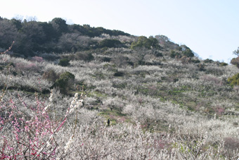
- Plum trees in the city park
In terms of historic sites:
- Shingu Miyauchi Ruins ( National historic site )
- Kamo Shrine ( National cultural heritage )
- Tatsuno Castle and old Nagatomi Samurai houses, which were owned by the Wakizaka Clan. They produced a rice harvest of 53,000 koku (1koku= 180 litters) annually, and was considered a middle sized Clan in the Edo era.
- Murotsu Port, which flourished during the Edo era
There are three hotels run by the city to accommodate tourists.
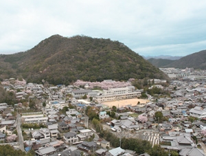
↑The Birdview of Tatsuno-city
1
2
9
2
3